USB GPS & AIS Dongle
These products simply plug into the USB port of your computer, giving a completely mobile solution to your navigation needs, the Bluetooth GPS requires no leads at all. The AIS just requires connection to a VHF antenna and the GPS gives excellent accuracy to fix your positon and allow all the route planning to take place in real time
|
|
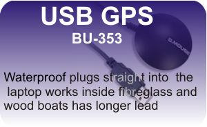
£48.95 inclusive of postage Compatible with Windows XP, Vista, 7 and 8, 10 and 11 With non-slip on the bottom and the special compact design, the GlobalSat BU-353 sirf4 Water-Proof USB GPS Receiver is completely self-contained and waterproof. It incorporating the latest SiRF Star IV GPS chipset and an active patch antenna so you receive a high degree of GPS accuracy. Baud rate 4800bps Scroll down to purchase |
|
|
|
|
|
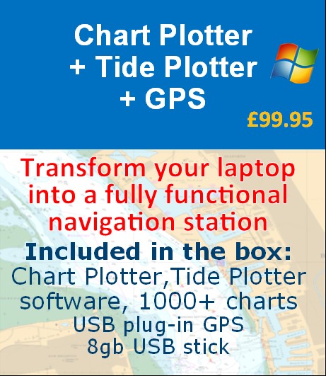
£99.95 post free Already have a laptop? then why not transform it into a fully functional navigation system for less than £100. Everything arrives in a box, post free. Belfield Chart Plotter software 1000 UK, Ireland and Channel charts Belfield Tide Plotter software USB GPS unit 8gb USB memory stick containing all the software
|
|
All prices listed below include postage and packing |
|
|
|
|
Prices shown below include carriage
| Quantity | Item | Unit Price |
|---|